


The Roads That Lead to Faith: Mercer County's Religious Heritage
Why do so many Mercer County roads, villages and landmarks carry names associated with churches? The answer reaches back to nineteenth-century settlement, when congregations helped shape communities and the names that survive on local maps.
Saint-Named Roads and Communities
St. Anthony Road, St. Joe Road, St. Peter Road, St. Johns Road and Sebastian Road are present-day examples of religious names on the landscape. Nearby churches and historic settlements share these names, but the precise date and official reason for naming each road remain unconfirmed. A connection on a modern map does not by itself establish that a road was formally named for a church.
Old maps help us investigate. The Daily Standard's interactive Mercer County map viewer offers layers from 1819, 1852 and 1915. The Ohio History Connection atlas collection identifies Mercer County atlases from 1876, 1888 and 1900. Comparing these maps with present-day road records may reveal when a name first appeared.
More Than One Denomination
Although Catholic parishes are especially visible in the Land of the Cross-Tipped Churches, Mercer County's nineteenth-century communities also supported Methodist, Lutheran, Presbyterian, United Brethren, Congregational and Christian congregations. Historical accounts of Celina and Fort Recovery document this variety. Their churches, schools, cemeteries and meeting places also belong in the story of how the county developed.
Carthagena: A History Before St. Charles
One of the most important examples stands in Carthagena. Before St. Charles Seminary occupied its site, abolitionist Augustus Wattles and supporters of the Quaker-funded Emlen Institute worked to educate Black and Native American boys. The surrounding free Black community was established in the 1830s and 1840s. In 1861 the Missionaries of the Precious Blood purchased the former institute property for a seminary. This layered history connects Black settlement, abolitionist and Quaker educational efforts, and later Catholic religious life in one place.
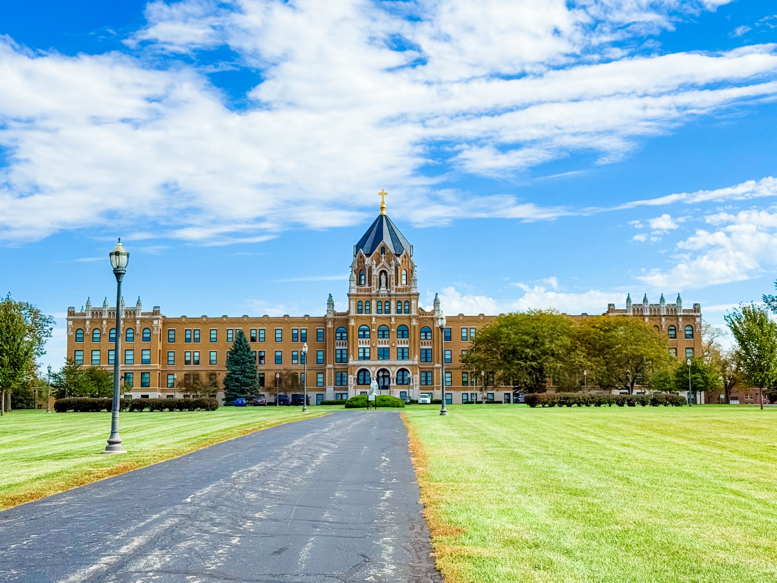
Historic accounts also document racial hostility that disrupted efforts by formerly enslaved people to settle on land purchased for them in Mercer County in 1846. That painful history is part of the county's story and should not be omitted.
Help Us Preserve Local History
Have an old photograph, family story, church record or piece of Mercer County history to share? We would love to hear from you! Local memories and historical details help us tell a fuller story of the communities we call home. If you have information to add or a correction to suggest, please reach out to Master Key Realty. We welcome contributions from neighbors, families and local historians across all faith traditions.
Explore the Churches
See our Land of the Cross-Tipped Churches guide for original local photographs of historic Catholic landmarks. This broader history project will also recognize the county's Protestant, Quaker and Black religious heritage as additional places and records are documented.
Research sources: Daily Standard historic map research; Ohio History Connection atlases; official scenic byway history; Shelby County Historical Society Carthagena history.